
Search Term Record
Metadata
Name |
Map |
Number of Archive records |
90 |
Number of Library records |
5 |
Number of Object records |
7 |
Number of Photo records |
8 |
Related Records
-
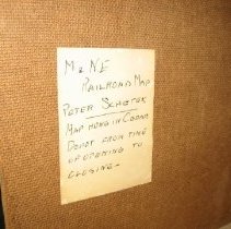
1958.64.02 - Michigan Railroad Map
"Old railroad map of Michigan shoowing old congressional districts. Lumber company office at Whitney from about 1912-1924"
Record Type: Archive

-
-
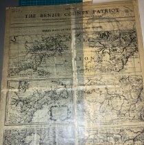
1968.25.06
Benzie Patriot, old maps. 21.75" H x 16.75"W. Supplement to the Benzie County Patriot from Thursday, June 8, 1939. They are titled, "Early Maps of the Great Lakes Region."
Record Type: Archive
-
1971.20.01
Map- Fox and Manitou Is. And sourrounding waters Large mounted on cloth For information about see Documents
Record Type: Archive
-
1985.03.03
Map- "Michigan School Furniture Co.'s New Map of Michigan" Copyright 1881
Record Type: Archive
-

-

-
-
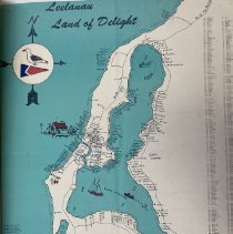
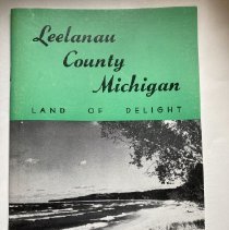
1987.66.01
Map. 24.5" x 18.5". " Leelanau Land of Delight" Includes Leland, East Leland and part of Lake Leelanau with names of property owners. Dated 1965.
Record Type: Archive
-
1988.28.01 - "Lake Leelanau, Michigan by John F. Nellist."
Map. Parchment with black ink. "Lake Leelanau, Michigan by John F. Nellist." North Lake Leelanau to the Narrows and Provemont with surrounding land. Names of land owners along shoreline of lake and Lake Michigan. Mr. Nellist was a caratographer for the state of Michigan. Lived in Grand Rapids, Michigan and lived on "View Hill Farm" on Horn Rd. in Leelanau County. Died in 1948. Scanned by Grand Traverse Reproduction April 2017 - See Acce...
Record Type: Archive
-

-

-
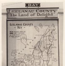
1990.23.74
Photo, Postcard. Sign map of Leelanau County. "Leelanau County "The Land of Delight." Print
Record Type: Photo
-
1990.36.72
Plat Map. 24x18" Plat of Terrace Place, Section 2, Town 30 North, Range 12 West" Registered 31 Aug. 09. Paper of cloth backing.
Record Type: Archive
-
1991.36.12
Booklet. "Leelanau County Michigan Vacation Guide 1961". Pub: Leelanau County Chamber of Commerce. Maps. Photographs. Brief Description of villages. Advertisements from county businesses
Record Type: Archive
-
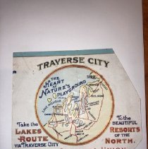
1991.79.154
Label. Fruit Growers Union, Traverse City, Mich. "To the Beautiful Resorts of the North"
Record Type: Archive
-
1992.42.01
Map. Manitou Mail Service - Mail run to North & South Manitou Islands & Crib. With directions of travel and running time.
Record Type: Archive

-

-
-